
Informative Mapping of Construction Aggregate Resources Through Statistical data Analysis
- 3 year project from 01.05.23 -30.04.26
- Total Budget 20.512.736 DKK
- IFD investment 14.508.913 DKK
Why Integrate
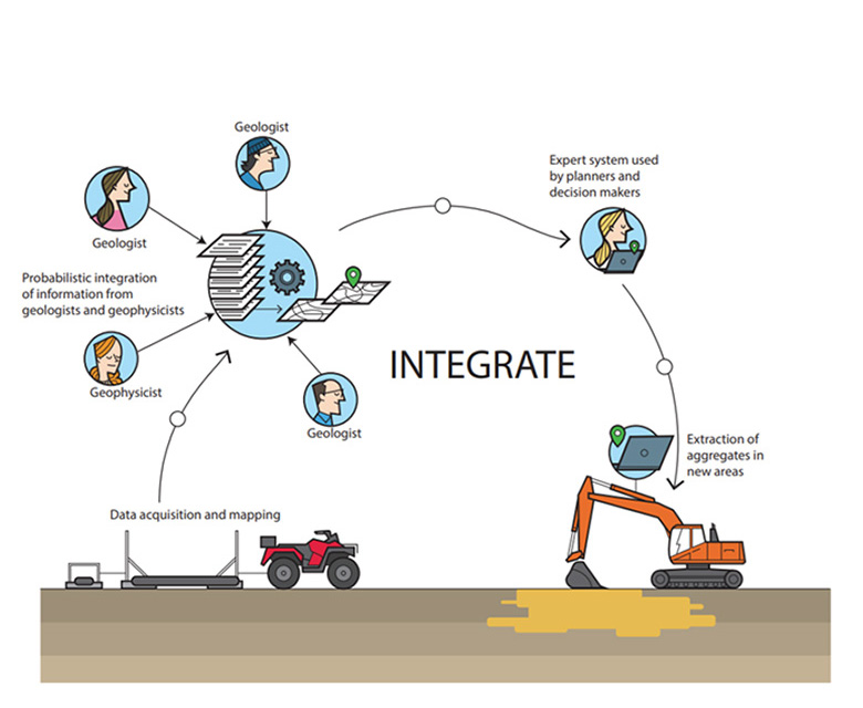
The need for construction aggregates like sand, gravel and stone is increasing in the future. Also, a significant part of the aggregate costs are related to transportation, as there is a mismatch between where the minrals are extracted and where they are used. To be able to support the increased need of these raw materials in the future, and to reduce the costs related to transportation, INTEGRATE aims to optimize the methods for mapping these aggregates using Electromagnetic data.


Project Goal
To be better to map the construction aggregate, INTEGRATE will be building a new and beyond state-of-the-art framework, based on information theory, allowing more informative mapping of aggregate resources using electromagnetic (EM) measurements.
On top of the mapping framework, we will develop a web-based frontend system, allowing decision makers to extract relevant information to perform aggregate resource extraction planning.
With this framework it will be possible to locate new aggregate resources, and in turn reduce transportation costs, contribute to less wear and tear on the roads, less noise and traffic concentration, and a reduction in CO2 emissions.
Expected Outcome
We hope that the project results will revolutionize mapping of the near surface, using EM data, and that the outcome will have a significant economic, societal and environmental impact. In addition, it will strengthen Denmark’s position as an international frontrunner on utilizing EM data in subsurface mapping, and also provide new export opportunities for Danish technology.
